Inside NOAA’s Warning: What a “Very Strong” Super El Niño Means for American Weather
NOAA warns of a looming Super El Niño. Discover how this powerful climate cycle will impact winter weather, rainfall, and temperatures across the U.S.
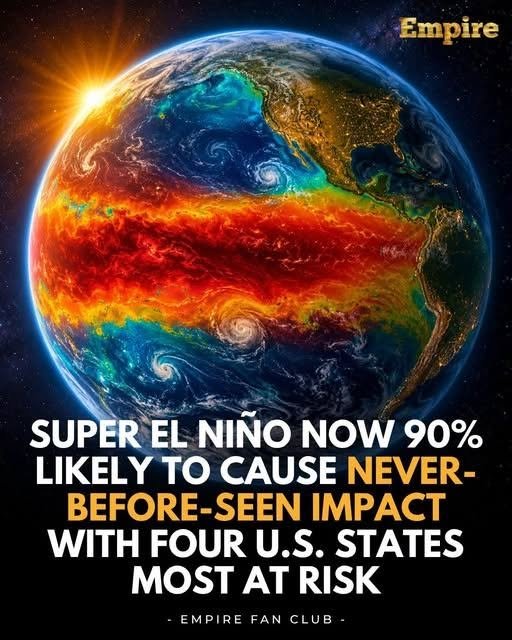
The Pacific Ocean is heating up in a way that has meteorologists on high alert. According to official advisories from the National Oceanic and Atmospheric Administration (NOAA) and international climate models, sea surface temperatures in the equatorial Pacific are surging toward critical thresholds. With atmospheric indicators locking into place, forecasters indicate a greater than 90% chance that a “very strong” or Super El Niño will dominate the upcoming fall and winter.
When the El Niño–Southern Oscillation (ENSO) shifts into high gear with this magnitude, it acts as a master conductor for global weather. For the United States, this transition signals a sharp break from standard weather patterns, threatening everything from drought relief in some regions to severe flooding and unseasonal warmth in others.
Understanding how this climate phenomenon operates allows communities, homeowners, and industries to prepare for the turbulence ahead.
The Mechanics of a Super El Niño
To understand why a Super El Niño commands such intense focus, you have to look at the sheer scale of energy shifting across the globe. El Niño is the warm phase of the ENSO cycle, characterized by above-average sea surface temperatures stretching from the coast of South America toward the International Date Line.
When these waters warm by 2° Celsius or more above normal, meteorologists classify the event as a “very strong” or Super El Niño. This massive pool of warm water alters atmospheric pressure systems, weakens trade winds, and shifts the Pacific jet stream southward. Once the jet stream is displaced, it acts as an atmospheric highway, steering heavy moisture systems, bitter cold fronts, and prolonged dry spells directly across North America.
Regional Impacts Across the United States
The ripple effects of a peaking Super El Niño are rarely uniform, carving distinct geographic winners and losers across the country as the seasons progress:
-
The Northern Tier and Upper Midwest: Expect a notably milder and drier winter. Cities that typically rely on heavy snowpacks and freezing temperatures often see compressed winter conditions, reduced heating demands, and lower mountain snow accumulation.
-
The Southern U.S., Gulf Coast, and Florida: Get ready for a wetter, stormier cool season. The southern jet stream funnels a relentless parade of atmospheric moisture onshore, drastically increasing the risk of heavy downpours, localized flash flooding, and severe weather outbreaks, including an elevated threat of winter-season tornadoes.
-
The Southwest and California: A robust El Niño traditionally delivers much-needed soaking rains and heavy high-elevation Sierra Nevada snowpacks to the Southwest, though the extreme intensity of a Super El Niño can occasionally tip past beneficial hydration into dangerous mudslides and saturated soils.
-
The Pacific Northwest: This region frequently experiences drier and warmer-than-average conditions during a strong El Niño phase, which can prematurely stress regional water reservoirs heading into the following spring and summer.
Comparing Normal Winter Patterns vs. Super El Niño Impacts
| Region | Typical Winter Conditions | Projected Super El Niño Impact |
| Pacific Northwest | Cool and wet with heavy mountain snow | Warmer and drier than average, lower snowpack |
| Northern Plains & Midwest | Sub-zero freezes, consistent snow cover | Milder temperatures, significantly less persistent snow |
| Southwest U.S. | Variable winter storms | Enhanced rainfall and mountain snow |
| Southeast & Gulf Coast | Moderate, mixed weather systems | Wet, cool, and volatile with increased severe storm risk |
Pros and Cons of a Super El Niño Cycle
Pros:
-
Can provide substantial, drought-busting precipitation to parched agricultural regions in the American Southwest and California.
-
Often correlates with a quieter Atlantic hurricane peak during the tail-end of the season due to increased wind shear across the tropics.
-
Lowers peak-season heating utility costs for households across the northern tier of the country.
Cons:
-
Drastically increases the frequency of flash flooding, severe coastal erosion, and mudslides in saturated southern regions.
-
Threatens winter tourism and snow-dependent economies in the Midwest and Northeast due to lack of snow cover.
-
Can disrupt global agricultural yields, impacting commodity prices and supply chains.
Common Mistakes and How to Prepare
-
Mistake: Assuming a warm winter up north means you don’t need to winterize your home.
-
The Fix: Even in a mild overall season, Super El Niños can trigger sharp, volatile Arctic plunges overnight. Insulate exposed pipes and clear gutters regardless of long-range temperature trends.
-
-
Mistake: Ignoring flood preparation because you live in the South or Southwest.
-
The Fix: With the southern jet stream locked in, saturated ground quickly turns into flash flooding. Check your sump pumps, clear local storm drains, and review your property’s flood insurance policy.
-
-
Mistake: Relying on outdated historical averages for seasonal planning.
-
The Fix: Because climate change interacts dynamically with modern El Niño cycles, expect amplified extremes. Base your preparations on NOAA’s active climate outlooks rather than past assumptions.
-
Expert Insights and What Comes Next
Climatologists note that the ongoing evolution of this El Niño event highlights a broader trend: Earth’s climate background state is warmer than it was during past historical benchmarks, meaning natural cycles like ENSO now play out on a super-charged stage.
As the ocean-atmosphere coupling continues to strengthen through the autumn months, emergency managers and agricultural planners are already adjusting protocols. The transition out of a strong El Niño typically occurs rapidly during the following spring, often swinging the pendulum toward neutral or La Niña conditions, which can introduce a whole new set of weather whiplash risks.
Frequently Asked Questions
What exactly is the difference between a regular El Niño and a “Super” El Niño?
While a standard El Niño requires sea surface temperatures in the central-eastern Pacific to rise 0.5°C above normal, an informal “super” or very strong El Niño occurs when those anomalies surge past 2.0°C, triggering vastly amplified global weather disruptions.
Will a Super El Niño guarantee a drought-free California?
While it generally brings above-average precipitation to California, it does not completely eliminate drought risks. Furthermore, intense downpours can overwhelm infrastructure, causing severe localized flooding rather than manageable hydration.
How does El Niño affect winter heating bills?
Homeowners in the northern United States and parts of the Midwest often experience lower heating bills due to milder-than-average winter temperatures. Conversely, southern households may see increased cooling or fluctuating energy demands.
Does El Niño impact summer weather as well?
El Niño exerts its peak influence on North America during the late fall, winter, and early spring. By late spring and summer, the pattern typically decays or transitions into a neutral or La Niña phase.
Can El Niño cause severe weather and tornadoes?
Yes. The southern track of the jet stream brings contrasting air masses together over the Gulf Coast and Southeast, frequently fueling winter and early-spring severe thunderstorm outbreaks, including tornadoes.
Where can I track daily updates on the El Niño status?
The NOAA Climate Prediction Center and the International Research Institute for Climate and Society (IRI) publish monthly diagnostic discussions and probabilistic models tracking ENSO progression.
Are ski resorts ruined during a Super El Niño winter?
Ski resorts in the Pacific Northwest and parts of the northern Rockies often face below-average snowpack and challenging conditions, though high-altitude southern resorts can occasionally benefit from heavy storm tracks.
How long are these Super El Niño events expected to last?
Current meteorological models indicate that the event will peak during the late fall and early winter months before beginning a gradual weakening trend into the following spring.
Action Checklist
-
What to do:
-
Clear property drainage systems, gutters, and culverts ahead of heavy southern winter rains.
-
Review home insurance policies, ensuring adequate coverage for potential flooding or wind damage.
-
Monitor local NOAA advisories weekly as seasonal forecasts sharpen.
-
-
What to avoid:
-
Disregarding severe weather alerts because “it’s just an El Niño winter.”
-
Leaving outdoor assets vulnerable to sudden, volatile temperature swings and heavy moisture.
-
As NOAA’s models point toward a formidable Super El Niño shaping the months ahead, shifting from passive awareness to proactive preparation is essential. Whether bracing for heavy southern rainfall or adapting to an unseasonably warm northern winter, respecting the power of this Pacific climate driver will help safeguard homes, budgets, and communities.
NOAA’s Super El Niño warning signals a major disruption to standard U.S. weather patterns, bringing heavy flood risks to the South and unseasonable warmth to the North.